|
Today is:
Tuesday 15.07.2025
Weather

©2008 Mediapool
|
ergis.cz > Sourek's trail through Obri dul and Upa peat bog to Vyrovka
hiking path
Ergis #ID: 633
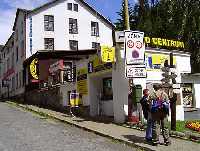
Sourek's trail through Obri dul and Upa peat bog to Vyrovka
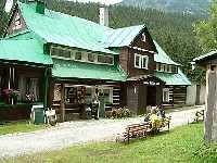
Pec pod Sněžkou Information centre Turista - Pec pod Sněžkou Information centre Turista
detailed map
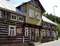
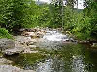
This quite difficult trail starts at the center of Pec pod Snezkou. Follow the blue trail towards the small chapel. This trail gradually passes the turn towards the bottom stop of the chair lift to Snezka, the Information Centre KRNAP, several mountain chalets and Kavina's memorial. You will walk through the first and the second zones of the national park for most of the journey and that's why it's recommended to be very considerate towards mountain wildlife. When you reach the little chapel you will actually be standing by the remnants of the old dam called "klauza" from the 16th or the 17th century (used to float the timber in seasons with hardly any water). The 150 kilometres long journey of the Giant Mountains timber down the Upa and Labe river started just here and it went all the way to Kutna Hora, the royal town where the silver mines were. To the left you can see a tract caused by snow avalanches. It's in Mala Studnicni Jama / the Small Well Corrie, where a large avalanche went down in the year 1962. The view of Dolni Upsky vodopad / the Lower Upa Waterfall starts to open for you on the left of the trail behind the small chapel. In the winter this trail does not carry on any further. In the summer you can cross the track of one of the fatal landslides on the right hillside and you walk up towards the place which commemorates the glorious mining history of Obri dul called "Kovarna" / the Blacksmith Forge. The view of Certuv hrebinek / the Small Devil's Range and outstanding biological locations Certova Rokle / the Devil's Gorge and Certova zahradka / the Devil's Garden are visible directly opposite Kovarna on the hillside of Studnicni hora / the Well mountain.
The trail is taking you further up the alpine tree line where you can meet flag forms of the spruces and dwarf pine stands. Soon after you get out of the forest on the right you will see a reservoir for the Snezka mountain which is sometimes called "trkac". The correct name of this instalation is Pelton's turbine. Next you will cross one of the landslide tracks in Obri dul. This way you can see Upska jama / the Upa Corrie on the oposite side which is framed by Upska hrana / the Upa Edge where the most famous Giant Mountain garden is, called Krakonosova zahradka / the Krakonos's Garden.
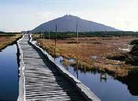
You can carry on towards the border range to places where you can tell there used to be a chalet thanks to levelled ground and typical anthropogene vegetation. Obri bouda / the Giant Chalet was there till 1984. Slezsky dum / the Silesian House was luckier. It survives on the Polish side of the border till now. At this point there is choice of trails to follow. You can either join the red trail towards Spindlerovka Chalet or you can walk in the other direction to Pomezni boudy / the Boundary Chalets across Upske raseliniste / the Upa Peat Bog.
You can carry on across the peat bog to Lucni bouda / the Meadow Chalet. It's the biggest, probably the oldest and definitely the most legendary chalet of the Giant Mountains. You have a possibility to join the trail towards udoli Bileho Labe / the White Labe Valley. The White Labe springs from Upa Peat Bog. Continue down the red trail past Renneruv kriz / the Renner Cross and Pamatnik obetem hor / the Victims of the Mountains Memorial.
You are leaving Lucni hora / the Meadow Mountain on the right. Vegetation and the animals and also the landscape have an extreme northern appearance. The best example of this landscape can be seen in Lucni hora. The formation of the shape was mainly done by water and frost, which created the terraces, stone seas and polygonal network filled with rougher pieces of rock - so called - polygonal soils. You will also cross the line of the border defences. The construction of these started in 1937. The small bunkers for 7 men were called "ropiky" because of the abbreviation ROP. Their density was 6 per 1 km. By Vyrovka chalet you need to turn to the green trail down to Pec (the original building came from the 18th century). There are different possibilities for you descent further, next to Richterovy boudy / Richter Chalets. You can either walk down following Divoky potok or you can walk down a trail called Zelezna stezka.
| Length | 18 km | Level | 5 | | Elevation rise | 754 m | Technic | 4 | | Maximal altitude | 1398 m | Landscape | 4 | | Minimal altitude | 755 m | Funfactor | 4 |
|
|