©2008 Mediapool
|
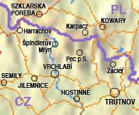
Čistá v Krkonoších, Fořt Zip code: 543 44
Number of inhabitants: ca. 733
Elevation: 684 m above the sea level info@cernydul.cz, starosta@cernydul.cz
www.cernydul.cz The community is member of union:
The Krkonose Mts. - Union of Municipalities
The Eastern Krkonose Mts. municipalities' union
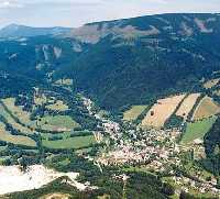
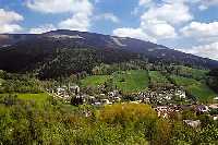
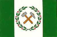
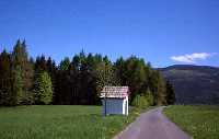
Originally a mining settlement in the valley of the Cerna creek in the foothills of the Krkonose Mountains. The name of Cerny Dul (black pit ) probably comes from its location in the middle of the deep black woods. The community includes Cista v Krkonosich and Fort. The community is an ideal starting point for trips to the Cerna hora and the Lisci hora (Black and Fox Mountain) and to the town of Janske Lazne.
History:
The origin of Cerny Dul is related to the beginning of ore mining in the Krkonose Mountains in 1383. Krystof of Gendorf acquired the estate in 1533 and implemented his large-scale plans of gold, silver and ore mining. Cerny Dul got the authority of a free mining town in 1564. The decline of mining started in the 17th Century and led to a complete closing of the mines in 1817. Since 18th Century up to the present day limestone from the Cerny Dul area is well known. It was limestone from Cerny Dul that was used during the contruction of the citadel in Josefov. Today, 9km long cableway transfers the limestone from Cerny Dul to the mine in Kuncice for processing.
|
|