Search for:Visitor number ©2008 Mediapool |
Ergis #ID: 22
Malá Úpa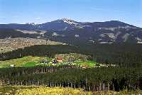 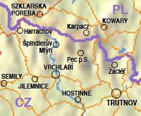
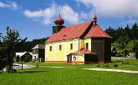
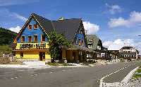
 Horní Malá Úpa, Dolní Malá Úpa Zip code: 542 27 malaupa@malaupa.cz The community is member of union: It is a typical mountain settlement with characteristic original cottages spread over the slopes with a number of sights, mainly the church of St. Peter and Paul from 1791 (a church at the highest elevation in the Czech Republic). On the Pomezní Boudy is the administrative center of the municipality, with a border crossing to Poland. The conditions are right for cross-country and downhill skiing, mountain biking, interesting hiking tours with beautiful views, strenuous tours to the highest point of the municipality and the Krkonoše Mountains – Snežka at 1602. The selection of accommodation and restaurants is wide, to satisfy all levels of taste. The main advantage of this mountain village is its peaceful und quiet environment appreciated by all visitors.
History: Sights:
Institutions:
|