©2008 Mediapool
|
hiking path
Ergis #ID: 615
Trail of Czech - Polish Friendship: Špindlerova bouda - Harrachov
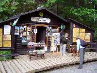
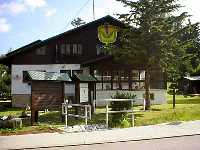
Špindlerův Mlýn Seasonal information centre KRNAP Labský důl - Harrachov Information centre KRNAP
detailed map
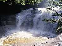
If you want a longer view, if you want to meet rich geological past, memories of the first skiers, or stop at the Krkonoše waterfall with the largest volume of water, you've chosen the right route.
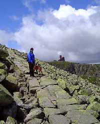
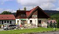
From Dívčí lávky to Špindlerova bouda/chalet. We can reach the 170 year old Špindlerov bouda, in the Slezské sedlo/Silesian saddle, both from Dívčí lávky and from Špindlerův Mlýn by bus, or by following the green-marked trail (from Dívčí lávky, 3 km). We continue on the red-marked trail in the westerly direction. At Čihadla, we can see small peat-bogs which contain the carnivorous plant, sundew (Drosera rotundifolia).
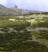
From Špindlerova bouda to Petrova bouda /chalet we continue on the red-marked trail and, after 2 km, we meet the blue-marked trail turning to the left. During summer, we can choose to turn or to continue on the ridge, but in winter only the trail passing Petrova bouda can be used. From Petrova bouda we return to frontier ridge by the yellow-marked trail and continue on the red one.
From Petrova bouda to Sněžné jámy/Snow Corries ascend to Dívčí/Girls' and Mužské kameny/Male Stones, distinctive rocks with nice views. We pass two memorials, Kalman and Rys, and at Rys, we leave the Polish border and travel to the highest mountain of western Krkonoše - Vysoké Kolo/High Ring, 1508 m above sea level. On the right, we can view Velká a Malá Sněžná jáma/Big and Little Snow Corries with glacial lakes.
From Sněžné jámy to Vosecká bouda/chalet and to the valley of Mumlava. We now continue further to Violík. After another 3/4 km and we reach the crossing with the yellow-marked trail (it leads to the source of the Labe - 1/2 km. The trail leaves the Polish border to Poland, we pass the top of Sokolník and at the crossing of the red-marked trails at Tvarožník, we turn left from the border ridge to Vosecká bouda/chalet and to the forested valley of the Mumlava river. At the river, our route meets the blue-marked Harrach trail and they jointly continue to today's last stop, Mumlavský vodopád/waterfall. Its fall is only 8 m but it has the greatest volume of water of all waterfalls in Krkonoše. Also, here we meet interesting shapes created in granite - in the rapids of the waterfall, a whirling of water has hollowed out holes in rocks - the biggest ones in the Czech Republic (with a diameter of 5 to 7 m and a depth of 3 m!). From the waterfall, we descend either by the blue-marked trail to the bus station in Harrachov or by the longer red-marked trail to Harrachov - Nový Svět. | Length | 19.5 km | Level | 4 | | Elevation rise | 498 m | Technic | 3 | | Maximal altitude | 1198 m | Landscape | 5 | | Minimal altitude | 700 m | Funfactor | 4 |
|
|