©2008 Mediapool
|
MTB tour
Ergis #ID: 655
Harrachov - Vrchlabi (MTB)
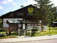
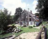
Harrachov Information centre KRNAP - Vrchlabí Information centre KRNAP - Tri domky
detailed map
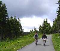
This trail leads most of the time on bad quality asphalt from the western part of Krkonose Mountains all the way to south center of Krkonose Mountains. On this tour you will have several opportunities to see wanderful views of the whole area, especially of nearby Jizerske Mountains, hills of Plesivec, Lysa Hora, Kotel, Szrenica and Zaly. There are several rest-stops possibilities on this trail.
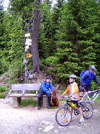
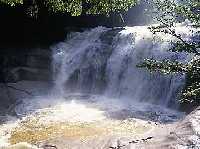
From Harrachov we will bike along the river of Mumlava to the Mumlava waterfalls (cyclotrail No.2). From this point we will back track a little before heading northwest to the upper part of Harrachov (cyclotrail No2A). Turning right continue along the creek of Kamenice up to the mountain of Jaksin. Continue further on to the boundary of the Zone II. of the national park around the mountain of Kamenec up to the junction leading to Vosecka Bouda over the hill Tvaroznik. The trail to Vosecka bouda is closed for biking but you may walk your bike up the hill. It is only 1,2km to Vosecka Bouda where you will be rewarded with a beautiful view.
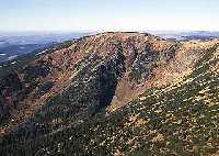
Below Vosecka bouda we will bike down the hill to the river of Mumlava. Turn left at a junction called Krakonosova snidane (cyclotrail No.2B). Bike around the mountain of Plesivec and down to Krakonos trail (cyclotrail 1A). This is the starting point of biking up hill to Lysa hora and Kotel towards the chalet of Dvoracky. From Dvoracky bike appr. 400m down a bad stony trail. The trail continues following the green marking (cyclotrail 1A) down to the main road and further on to hotel Praha. Here turn left (cyclotrail No.10). Ahead of you is the last up hill trail to junction of Rovinka. From Rovinka you can bike on a good asphalt road to Benecko, Knezice and down to Vrchlabi.
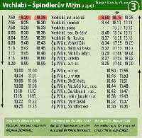
For the trip there and back use the Cyclobus!
| Length | 50 km | | Elevation rise | 1200 m | | Maximal altitude | 1200 m |
|
|