©2008 Mediapool
|
MTB tour
Ergis #ID: 818
Where the River Elbe Flows (MTB)
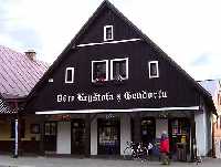
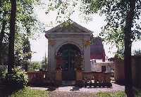
Vrchlabí lower station of the lift Zaly - Hostinné Railway station
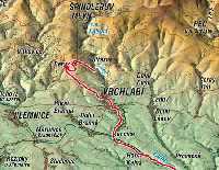
detailed map
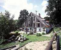
Vrchlabí/Herlíkovice - Žalý - Benecko - Vrchlabí - Kunčice - Hostinné
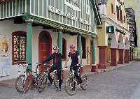
Starting point: Vrchlabí/Herlíkovice, cableway 680m above the sea level
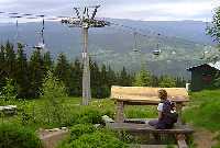
Highest point: Zaly 1018m above the sea level
Surface: stoney forest path, asphalt roads
Characteristics:
Easy MTB/cross bike trail through the foothills of the mountains. Near by of the town Vrchlabi there is a beautiful view point from Zaly. Down hill descent from Zaly to Benecko is technically difficult. The surface is mostly stones and especially after rainy days we do not recommend to go down on the bike.
Description:
Trail starts at the cableway in Vrchlabi/Herlikovice. Use the chairlift to go up to Zaly (1018m above the sea level) with a stoney look-out tower. From this point you have a great view over the central part of Krkonose. Trail continues from here down to Benecko, around the chapel of St. Anne down to the center of Vrchlabi. From down town Vrchlabi follow the main road around the industrial area of Skoda company to Hostinne, all the way along the river Labe.
Options:
Do not use the chairlift to Zaly and bike straight from Vrchlabi direction Hostinne. This way the trail can be also used with trecking and road bikes.
From Hostinne it is possible to take "Labska cyklotrasa" (Elbe cycling route) No. 24. | Length | 27 km | Level | 1 | | Maximal altitude | 1018 m | Technic | 3 | | Minimal altitude | 350 m | Landscape | 5 |
|
|