©2008 Mediapool
|
hiking path
Ergis #ID: 646
Krakonos' Path
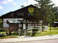
Vítkovice Parkoviště Horní Mísečky - Harrachov Information centre KRNAP
detailed map
Krakonos is one of the legendary creatures, whom our forefathers thougth to be responsible for the Krkonose Mountains and also for the fortunes of its inhabitants. We shall follow this road named after him so that we have enough opportunities to get accustomed to his mountain kingdom.
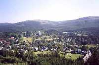
The route beginsat the enclave of Horni Misecky. the settlement of this area was first mentioned in the 17th century (1642) and was probably connected with ore mining. Nowadays it is a well known winter sport centre. At first we will walk comfortable Masarykęs Moountain Road and after several hundred meters we will turn on a green stripe-marked tourist trail - Krakonosęs Path (until 1920 it was called The Jubilee road of Franz Josef - king of the Austrian Empire). The road leads through forests on the south-west slopes of the Krkonos mountain.
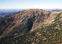
Approximately in the middle of the journey to Kotelni jamy corries the visitors will find halfway overgrown meadow enclave - a place where Kotelska bouda cottage was built in 1708. This was one of the first mountain farms in the western part of the Krkonose Mts. The cottage murnt down in 1910 and it went into ruins. 1,5 km further the scene of mountain spruce stees breaks open and we find ourselves face to face to the wild scenery of the glacial cirque of Velka Kotelni jama corrie.
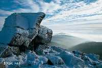
If you turn and look back the direction to Kotelni jamy corries, you will notice two striking formations above the Valka Kotelni jama corrie. One of them is natural - the tor of Harrachovy kameny stones (1421 m a. s. l.) - the other one is artificial - mound of Hanc and Vrbata. this monument reminds us of the tragedy of two Czech skiers who died close to this place during the ski race held in 1913.
The Krakonosęs Path goes through the south-west slope of Kotel, the most striking mountain in the western part of the Krkonose Mts. (1435 m a. s. l.), until it reaches the woodless enclave of Dvoracky, which used to be the centre of business life in the western part of the Krkonose Mts.
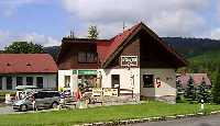
The contemporary Dvoracka cottage is a witness to previous periods of successful farming in the western parts of the mountains and although there are no cows pasturing on the meadows around it any more, it is worth staying here for a little refreshment and looking inside. You will see a traditional wooden interior of a mountain cottage there. You may as well notice brightly flowering mountain meadows (arnica, catęs-ear, anemone, gentian, geranium, gartsia and many others) surrounding the Krakonosęs Path. the road crosses the enclave of Dvoracky and it slowly descents on the south-west slopes of Lysa hora mountain. It goes through four skiing slopes, which lead from the top of the Lysa hora mountain towards the valley of Rokytnice nad Jizerou.
From these places you may have a fascinating views especially on Rokytnice. If the weather conditions give a good visibility you may as well see panoramic outlook on Jested mountain, Jizerske hory mountains, through Vysocko, Cesky raj andthe Zvicina mountain near Dvur Kralove.
After reaching the cros-roads Rucicky the Krakonosęs Path bends and after 4 km way through forests in the scenic valley of Ryzi (formerly Sejfsky) potok stream there opens another woodless enclave in front of you. You will notice timber mountain cottages. Many of them have been damaged by tasteless architectural treatment. Now we come to Ryzoviste village, founded in the 14th century as a first settlement in Harrachov.
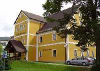
Around a little stone ridge Skalni stena we walk a comfortable road towards Harrachov. Originally this town was a glass and mining village, today it is a summer and winter sports centre of the western part of the mountains. | Length | 12.5 km | | Elevation rise | 520 m | | Maximal altitude | 1140 m | | Minimal altitude | 700 m |
|
|