©2008 Mediapool
|
hiking path
Ergis #ID: 599
Harrach's trail
pindlerův Mlýn Bílý most v centru - pindlerův Mlýn Labska bouda
detailed map
Recommended hiking trail by Headquaters of the Krkonose Provincial Park. ( In winter, this trail is open only to the Pudlava tributary (4km).
The trail through Labský důl/Elbe valley was established by the Count of Harrach in 1879. We could also call it the trail of nature conservation history in Krkonoe or the "trail of glaciers". We will be accompanied by the largest Czech river, the Labe/Elbe, traces of glacial activities and memories of the first Krkonoe nature conservationists.
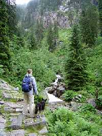
From downtown of Spindleruv Mlyn follow the blue marked hiking trail to "Divci lavky". From Divčí lávky/ Girl's footbridges to Dvorský potok/brook. We begin where, once upon a time, a 5 km long glacier ended, which modelled the valley. The path moderately rises up on the right bank of the Labe which, after 1 km, meets its left side tributary - Medvědí potok/Bear Brook. A little above the mouth of the brook about 20 m high moraine (stony elevation shifted by glacial activity) is visible. Then the path crosses the Labe and follows it on the other side. Where we cross the Dvorský potok the slope of Krkono mountain rises on the opposit side. Above us there is an old virgin forest - proclaimed in 1904 as the 1. Krkonoe nature reserve - Strmá stráň / Steep Slope.
From the mouth of Dvorský potok to the mouth of Pudlava and to Labské jámy/ corries. At the next tributary, Pudlava, the bike and ski trail end. On the slopes to the left, avalanche slopes appear. Labský důl is the richest for them among all of the Krkonoe valleys - we can count 11 of them from here.
ATTENTION!!! This trail is closed during winter! In summer, this path leads us further under three Labské jámy/ corries - Harrachova, Pančavská and Navorská.
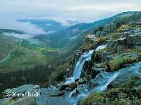
Under Labské jámy to Labská rokle/gorge. This trail is steeper, we will pass meadows consisting of vegetation requiring high humidity and while taking a rest we can observe 200 m slopes of corries. Behind Harrachova jáma we leave the Labe which begins to meandre (making many turns and curves instead of following a straight course) in granite bedrock which has been strongly weathered here. The most impressive corrie we will see Pančavská jáma with Pančavský vodopád/waterfall, which falls to a depth of 250 m, and Schustlerova zahrádka. Here we cross into the 1. zone of the national park - this is the most strictly protected area so from this moment we should remain only on the marked tourist trails in order to lessen our impact on this environment. Under the well-developed corrie of Navorská jáma we pass into Labská rokle/gorge.
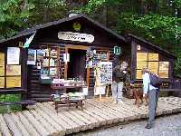
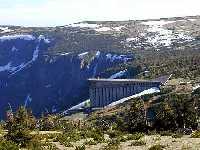
Through Labská rokle/gorge to Labská bouda/chalet. We cross the Labe and ascend a steep, twisting, winding footpath between Navorská jáma on the left and Labská rokle. Our final destination is Labská bouda, which was established in 1830 for tourist (this is different from most of the other Krkonoe chalets, which were first established as agricultural settlements.) In 1965, it burned down and ten years later the present building was opened, which unfortunately doesn't fit into the mountain scenery at all (the construction was located in a state nature reserve, today it are in the first zone, the most scritly rotected , of the national park ). On the left is the 45 m high Labský vodopád/waterfall. In 1859, floodgates were built on the waterfall (the owners of the chalet thus increased its size and attractiveness for tourists).
Where can we go from here? From Labska bouda, we can return by the green-marked trail to Martinova bouda/chalet (7km) or by the red-marked Buchar trail (10km) to Spindleruv Mlyn. | Length | 8.7 km | Level | 4 | | Elevation rise | 520 m | Technic | 3 | | Maximal altitude | 1300 m | Landscape | 5 | | Minimal altitude | 780 m | Funfactor | 4 |
|
|


